Multnomah Falls Hike to the Top: My Experience on the Trail
Yes, you can hike to the top of Multnomah Falls, and if you have enough time, I think it is a much better experience than simply stopping at the famous viewpoint below. The Multnomah Falls hike to the top starts near the main viewing area, passes Benson Bridge and then climbs into the forest above the waterfall. What surprised me most was how quickly the place changed once I left the crowds behind: instead of spending the whole hike staring at the falls, I found myself walking through moss-covered forest, looking down over the Columbia River Gorge, following a creek and eventually seeing the water from above rather than below.
I did the hike during a fall trip to Portland, and my experience was quite different from what I had expected after seeing the standard photographs of Multnomah Falls. I knew about the huge waterfall and Benson Bridge, but I hadn’t realized how much there was beyond that first viewpoint. This article covers what the climb actually felt like, what I saw on the way to the Multnomah Falls top, how difficult the trail was, and the practical things I would want to know before doing it now.
What the Multnomah Falls Hike to the Top Is Really Like
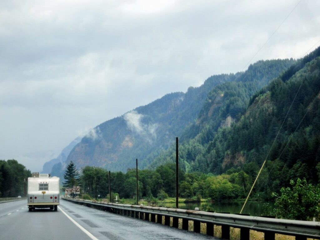
My visit started before I even reached the waterfall. We drove through the Columbia River Gorge, with steep forested cliffs rising beside the road and dense trees covering almost everything around us. At one point Multnomah Falls appeared through the trees in the distance, and only later did we reach the main viewing area where you get the familiar full view of the waterfall with Benson Bridge crossing between its two sections.
This was easily the busiest part of my visit. People were standing around the viewing area, taking photographs and looking up at the falls, and if you come only to see Multnomah Falls rather than hike it, you can get the iconic view without going very far at all. According to Travel Portland’s guide to Multnomah Falls, the waterfall is 620 feet high, and the main viewing area gives you the perspective that makes its scale easiest to understand.
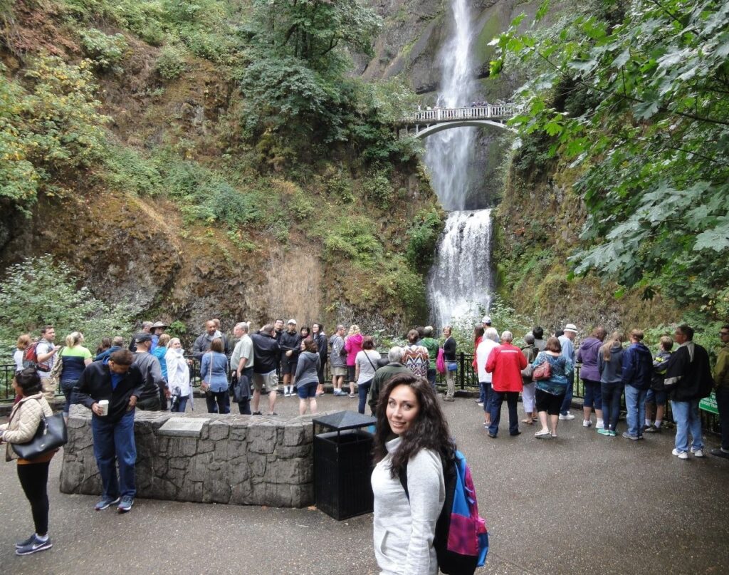
I started there too, but instead of turning around after taking photographs, we continued uphill.
That is where the experience changed. The farther I got from the bottom, the less it felt like visiting a famous roadside attraction. The trail entered dense forest, with enormous trees, moss, ferns and thick vegetation around it. There were sections where I couldn’t see the Columbia River or the main waterfall at all. If I hadn’t known how many people were gathered below us, I wouldn’t have guessed that one of Oregon’s most visited natural attractions was just down the hill.
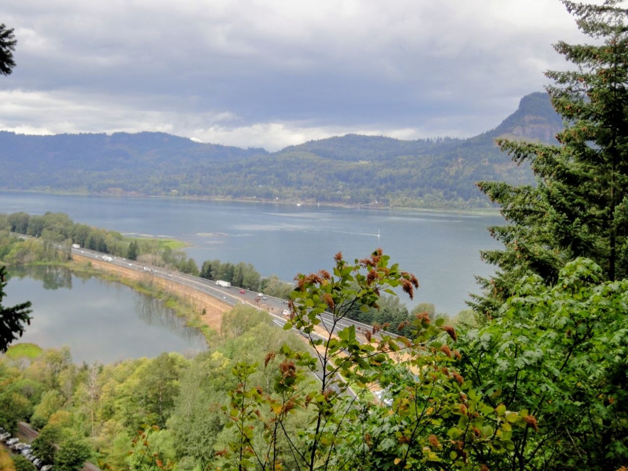
As we climbed higher, there were occasional openings in the trees where I could see the waterfall from a different angle. Eventually the forest opened enough to reveal the Columbia River Gorge below. I could see the river and the transportation corridor running alongside it, but from that height they looked surprisingly distant. That was probably the first point during the hike when I properly understood how far above the starting point we had climbed.
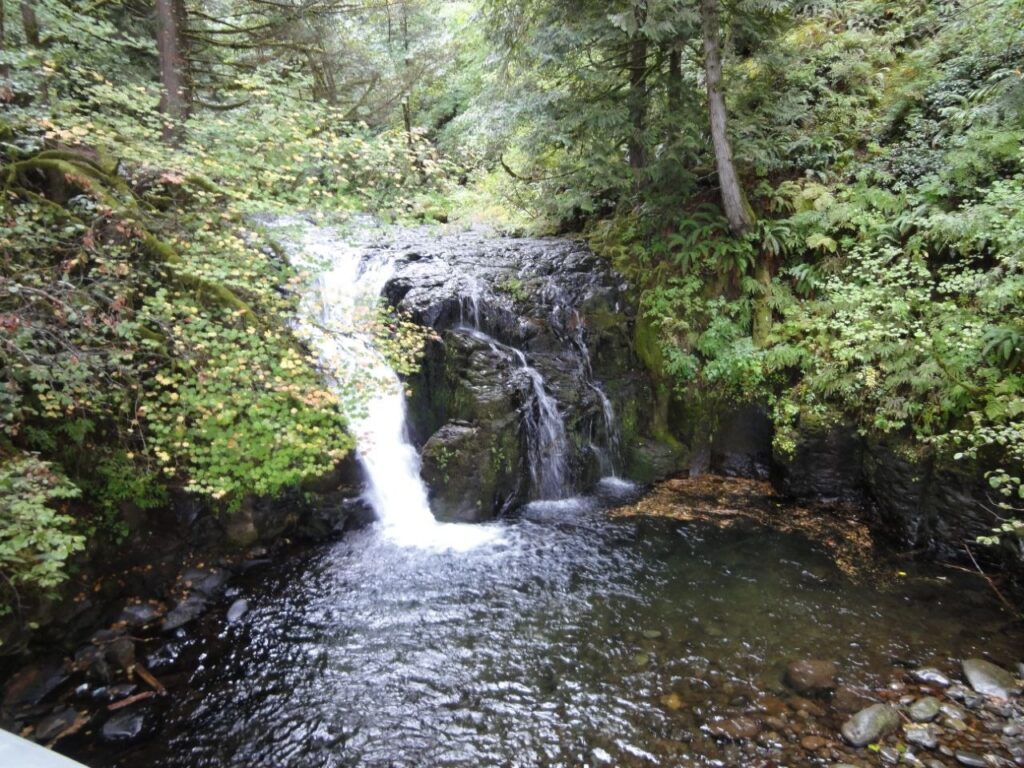
The scenery kept changing after that. We went back into the forest, where the trail was surrounded again by ferns and moss-covered trees. We eventually walked alongside a creek and passed a much smaller waterfall hidden among the trees. Later, near the upper part of Multnomah Falls, I could see the water moving through the forest toward the edge of the cliff.
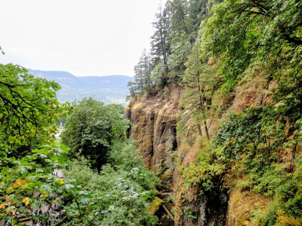
For me, that contrast was the best reason for doing the full hike. The bottom gives you the photograph everyone knows; the trail gives you the landscape that photograph leaves out.
If you enjoy trips built around a city but still want easy access to nature, this is also one of the reasons Portland works so well as a base. I keep similar combinations of cities, road trips and outdoor stops together in my US destination collection, rather than treating city travel and nature as two completely separate types of trip.
Multnomah Falls Trailhead: Where the Hike Starts
The Multnomah Falls trailhead is in the main visitor area around Multnomah Falls Lodge, so there isn’t a separate starting point that you need to find after visiting the waterfall. You can see the falls first and then continue onto the trail.
From the base, the initial path takes you toward Benson Bridge. The bridge sits between the lower and upper sections of the falls and is only about 0.2 miles from the main viewing area, so reaching it is a very different commitment from hiking all the way to the top. The official Portland guide to hiking Multnomah Falls describes the route to Benson Bridge as a short paved walk, while the climb to the top continues for about 1.1 miles and is considerably steeper.
That distinction matters because photographs can make the Multnomah Falls Benson Bridge hike look like the entire experience. It isn’t. If you walk to the bridge, take a few pictures and go back, you have seen the most recognizable part of Multnomah Falls, but you haven’t done the Multnomah Falls trail to the top.
I would also decide what you want to do before arriving. If you’re only visiting the base and bridge, this can be a relatively quick stop on a Columbia River Gorge drive. If you’re doing the Multnomah Falls hike from trailhead to the upper viewpoint, allow enough time for an actual uphill hike, stops for photographs and the walk back down.
One thing I wouldn’t do is judge the whole trail by the first few minutes. Around the lodge and lower viewpoint, the experience is dominated by the waterfall and other visitors. Once I continued uphill, the forest became a much bigger part of the hike than I had expected.
Hiking Multnomah Falls: The Trail, Switchbacks and Climb
The main thing to know about hiking Multnomah Falls is that the route is developed, but the climb is real. This isn’t a technical mountain trail where you need special equipment, but it also isn’t an extension of the flat viewing area at the bottom.
The path climbs the hillside through switchbacks. I remember sections with the slope rising beside the trail, followed by stretches where the trees opened and the Gorge suddenly appeared below. The constant change in surroundings helped because I never felt as though I was walking uphill simply to reach one final viewpoint.
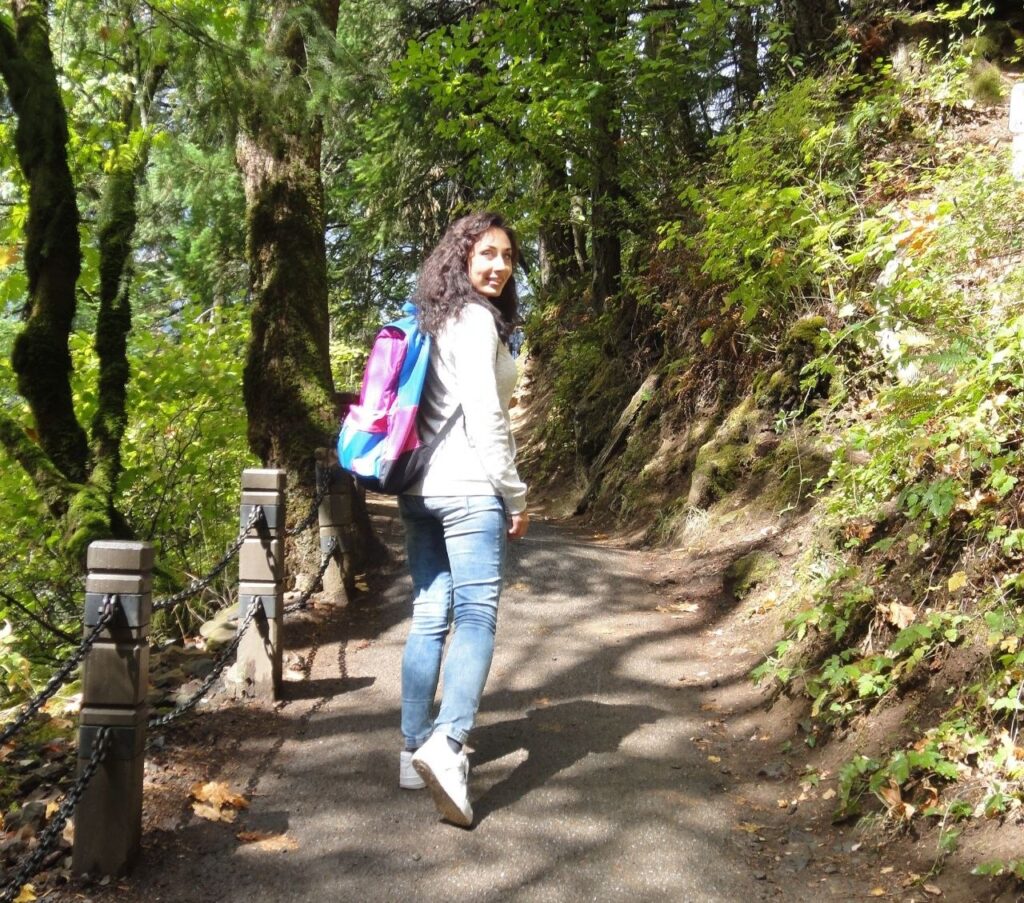
The Multnomah Falls hike difficulty comes mainly from the elevation gain and sustained uphill walking rather than difficult terrain. That makes a difference if you’re trying to decide whether the hike suits you. Someone who walks regularly and is comfortable with an extended climb will probably find it manageable, while someone expecting a five-minute stroll after Benson Bridge may find it much harder than expected.
It is also why I would consider this a reasonable Multnomah Falls hike for beginners, with one qualification: beginners should give themselves time. There is no advantage in trying to race through the switchbacks. I stopped several times, both because of the climb and because the views changed as I gained elevation. Those stops became part of the experience rather than something that delayed it.
One of the most memorable sections came when the trees opened and I could look across the Columbia River Gorge. From the base of Multnomah Falls, almost all your attention is directed upward toward the waterfall. Higher on the trail, the perspective reverses. You start looking outward and downward, and the Columbia River becomes part of the scenery.
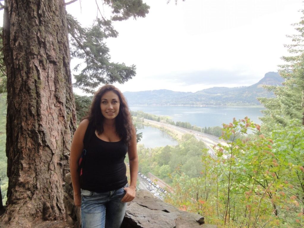
Then, surprisingly quickly, the wide view disappeared again. We continued through thick forest where ferns grew beside the path and moss covered the trees. That section felt quieter and much more isolated than the area around Benson Bridge. We eventually reached running water and followed the creek through the forest, passing a smaller cascade along the way.
This is the part I would emphasize to anyone asking how hard is the Multnomah Falls hike: don’t think only in terms of distance. A relatively short trail can still feel substantial when most of the outward journey is uphill. At the same time, there are enough changes in scenery that the climb doesn’t feel like a repetitive fitness exercise.
Proper shoes are worth wearing even though much of the main route is developed. The Columbia River Gorge is wet, and when I visited in fall there were damp areas, fallen leaves and plenty of moisture around the forest. I would rather have shoes with decent grip than choose footwear based on the fact that the trail is close to a major tourist attraction.
What You Actually See From the Multnomah Falls Top
The Multnomah Falls top isn’t where you go to get the best photograph of Multnomah Falls itself. That photograph is easier to take from below, where you can fit the waterfall, cliffs and Benson Bridge into one frame.
The reason to climb is that the perspective changes completely.
Near the upper part of the falls, I was no longer standing beneath a 620-foot waterfall looking up at it. I was beside the water above the drop, surrounded by forest, with the Columbia River Gorge stretching out below. I could see the water moving toward the cliff and, from the higher viewpoints, the river and road far beneath us.
We also spent time beside the creek above the falls. Looking back at my photographs, this is one of the details that makes the hike feel most different from the typical Multnomah Falls visit. There were no crowds posing in front of the famous waterfall behind us; there were trees, rocks, moving water and forest.
The U.S. Forest Service trail network around Multnomah Falls confirms how much larger the trail system above the waterfall actually is. The Multnomah Falls Overlook connects into trails extending farther through the Gorge, including routes toward additional waterfalls and Larch Mountain, so the upper area isn’t simply a dead-end viewing platform disconnected from the surrounding forest.
I wouldn’t recommend continuing onto longer connected routes without knowing exactly which trail you’re taking, but it explains why the upper part feels so different from the attraction below. You have moved from a roadside waterfall viewpoint into the Columbia River Gorge trail system.
The same thing is often true of crater and waterfall trips elsewhere: the viewpoint may be the reason you choose the destination, while the walk around it becomes the part you remember. I had a similar experience during a hike through the landscape around Wenchi Crater Lake, where getting away from the arrival point changed the experience completely.
So, can you hike to the top of Multnomah Falls? Absolutely, and I think the wording “to the top” can actually undersell it. You aren’t climbing simply to stand above the waterfall for five minutes. The forest, changing views over the Gorge, creek and quieter upper sections are what make the climb worthwhile.
Multnomah Falls From Portland
Doing Multnomah Falls from Portland is straightforward enough that I wouldn’t move accommodation just to be closer to the trail. Multnomah Falls is approximately 30 miles (48.3 km) east of downtown Portland, and the direct journey on Interstate 84 takes around 35 minutes without traffic. During busy periods, particularly in warmer months, Travel Portland says the same drive can take close to an hour.
That answers the basic how far is Multnomah Falls from Portland question, but the more useful point is that the short distance to Multnomah Falls makes it practical as part of a Portland trip rather than a separate overnight destination. You can leave the city, hike, spend more time exploring the Columbia River Gorge and return to Portland later the same day. After spending 10 days in the city, I think Portland is worth visiting for more than its urban attractions. Having places like Multnomah Falls so close makes it much easier to combine a city break with hiking and exploring Oregon’s natural landscapes.
If you’re choosing a base for the trip, I compared the areas I would actually consider in Portland in my breakdown of where to base yourself in Portland without making every journey difficult. For Multnomah Falls specifically, having convenient road access matters more than trying to find accommodation somewhere close to the waterfall.
There are also car-free options. Current visitor information lists shuttle connections into the Gorge, including services reaching Multnomah Falls, so renting a car isn’t the only way to make the trip.
For me, though, arriving by road was part of the experience. Before we even reached the falls, I was already looking at the steep green walls of the Columbia River Gorge through the car window. When Multnomah Falls finally appeared through the trees, it didn’t feel like arriving at an isolated attraction; it felt like one stop inside a much bigger landscape.
Directions to Multnomah Falls
If you’re looking for directions to Multnomah Falls, there are two main ways to drive there from Portland, and I wouldn’t automatically choose the fastest one. Interstate 84 is the direct option, while the Historic Columbia River Highway is the slower but much more scenic approach through the Gorge.
From downtown Portland, take I-84 east toward the Columbia River Gorge. For the main I-84 parking area, Exit 31 leads to the parking lot in the median of the interstate, with pedestrian access toward Multnomah Falls. This is the practical route if your priority is getting to the Multnomah Falls trailhead and starting the hike without turning the drive itself into a sightseeing trip.
The other option is the Multnomah Falls historic highway route along the Historic Columbia River Highway. This is the route I would consider if you have more time because Multnomah Falls doesn’t exist in isolation; the road passes through the forested Gorge and puts the waterfall into the landscape around it. Depending on the route and current road access, you can also combine Multnomah Falls with other waterfalls and viewpoints instead of driving there, hiking and immediately returning to Portland.
Travel Portland currently treats I-84 and the Historic Columbia River Highway as separate driving options, with I-84 being the faster route. Before choosing the historic highway, check current Columbia River Gorge road conditions through Oregon’s official TripCheck service, because closures and restrictions can affect sections of the Gorge.
If you’re wondering how to get to Multnomah Falls from Portland without a car, seasonal and year-round transit options into the Columbia River Gorge are also available, including services that stop at Multnomah Falls. I would check the current timetable for the exact day of the trip rather than relying on an old schedule, especially outside the main visitor season.
Multnomah Falls: Where to Park
The answer to Multnomah Falls where to park is more complicated than it was when I made my own trip, so this is one part of the article where I wouldn’t use my old experience as current advice.
For drivers using I-84, the large Multnomah Falls parking area is located at Exit 31 between the eastbound and westbound lanes. From there, visitors walk through the pedestrian tunnel beneath the interstate toward the lodge and waterfall. There is also parking closer to the lodge from the Historic Columbia River Highway, but availability and access arrangements are different.
The important issue is seasonal demand. Multnomah Falls is extremely popular, and parking rules have been introduced during busy periods to control congestion. For the 2026 season, timed-use permits are required for the I-84 Exit 31 parking lot from May 22 through September 7, 2026, between 9 a.m. and 6 p.m. The reservation fee is $2 per vehicle.
If you’re researching where to park for the Multnomah Falls hike, check the official reservation system shortly before your visit rather than assuming information from an older blog post still applies. The permit system has changed over time and may change again.
Also remember that parking for Multnomah Falls and parking for the hike are not two different things. Once you reach the main waterfall area, you can walk to the viewpoint, Benson Bridge and continue onto the trail from there.
Multnomah Falls Hours and When to Go
Searching for Multnomah Falls hours can be confusing because there isn’t one opening time that applies to everything at the site. Multnomah Falls itself is a natural attraction, while the lodge, restaurant, visitor facilities and other services operate on their own schedules.
For someone doing the hike, daylight and trail conditions matter more than restaurant opening hours. I would allow enough time to walk up without rushing, spend some time at the higher viewpoints and get back down comfortably before dark. This matters even more in fall, when daylight becomes noticeably shorter.
Crowds are another consideration. The lower viewing area was easily the busiest part of my visit, while the atmosphere changed considerably once I continued uphill. If your main goal is photography or simply seeing the waterfall, arriving early can make the base much more pleasant. If your main goal is hiking, don’t let a crowded first viewpoint convince you that the entire trail will feel the same.
Weather matters too. The Gorge can be wet, and a damp day changes the trail much more than it changes a quick visit to the viewpoint. Before leaving Portland, I would check current weather, trail closures and official alerts rather than looking only at the general Multnomah Falls hours.
Multnomah Falls in Fall
I visited Multnomah Falls in fall, and this is probably one of the reasons the forest sections stayed with me as much as the waterfall itself.
My photographs aren’t a wall of bright orange foliage. What I actually saw was much more typical of the Gorge: a lot of deep green, huge trees, moss and ferns mixed with yellowing leaves and darker fall vegetation. The damp-looking forest gave the trail a completely different atmosphere from the open viewpoint at the bottom.
This is worth mentioning because people searching for a Multnomah Falls hike in fall may expect the entire landscape to look like a classic New England autumn scene. I wouldn’t go specifically expecting that. The appeal is the combination of evergreen forest, moss, changing leaves, mist and water.
Fall also made the difference between the exposed viewpoints and enclosed forest sections much more noticeable. At one point I was looking down over the Columbia River Gorge; not long afterward I was surrounded by dense vegetation again, with almost no wide view at all. Later we reached the creek and smaller waterfall hidden among the trees.
The practical downside is moisture. Fallen leaves, wet pavement and damp sections can become slippery, particularly on the descent. Shoes with grip are useful even though this isn’t a technical trail.
Is the Multnomah Falls Hike to the Top Worth It?
For me, absolutely. If I returned to Multnomah Falls, I wouldn’t go only for the lower viewpoint.
The famous view is beautiful, and I understand why many people stop there. You can stand below a 620-foot waterfall, photograph Benson Bridge and see one of Oregon’s best-known landmarks without doing a substantial hike. If you have very little time, that’s still worth doing.
But it wasn’t my favorite part of the visit.
What I remember most clearly is leaving that busy area, entering the forest and gradually realizing how high we had climbed when the Columbia River appeared far below. I remember the huge moss-covered trees, the ferns around the trail, walking beside the creek and seeing a smaller waterfall tucked into the forest. At the upper part of Multnomah Falls, the experience was almost the reverse of the one I’d had at the beginning: instead of standing with a crowd looking up at the water, I was above it looking out toward the Gorge.
That’s why my answer to is Multnomah Falls hike worth it is yes, particularly if you’ve already made the trip from Portland. Going only as far as the main viewpoint shows you Multnomah Falls; continuing upward lets you experience much more of the Columbia River Gorge.
FAQ
How long is the Multnomah Falls hike to the top?
The trail from the main Multnomah Falls area to the upper viewpoint is about 1.1 miles each way, so expect roughly 2.2 miles for the basic out-and-back route. If you’re wondering how long does it take to hike Multnomah Falls, I would allow around 1.5 to 2 hours for the hike rather than calculating the time from distance alone. The climb, viewpoints and photo stops can easily slow you down.
How hard is the Multnomah Falls hike to the top?
The hike is moderate rather than technically difficult. The trail is developed, but you gain a considerable amount of elevation over a fairly short distance and spend much of the outward journey climbing. For me, the switchbacks and uphill sections made it feel like a proper hike rather than an extension of the sightseeing path below.
Can you hike to the top of Multnomah Falls?
Yes. You can walk from the main visitor area past Benson Bridge and continue uphill on the trail toward the Multnomah Falls upper viewpoint. You don’t need climbing equipment or a separate trailhead to reach the top.
Where does the Multnomah Falls trailhead start?
The Multnomah Falls trailhead is at the main Multnomah Falls visitor area near the lodge. The route initially takes you toward Benson Bridge before continuing uphill through the forest.
How far is Multnomah Falls from Portland?
Multnomah Falls is approximately 30 miles, or 48.3 km, east of downtown Portland. In light traffic, the direct drive via I-84 takes roughly 35 minutes, although busy periods can make the journey considerably longer.
Where do you park for the Multnomah Falls hike?
The main I-84 parking area is accessed via Exit 31. Seasonal timed-entry requirements can apply, so check the current rules before driving out from Portland rather than assuming you’ll be able to arrive and park without a reservation.
What are the Multnomah Falls hours?
The waterfall, trail and Multnomah Falls Lodge should not be treated as having one universal set of hours. The lodge and visitor services have operating hours of their own, while trail access can depend on current conditions and closures. Check official information for the date of your visit, particularly if you’re planning an early or late hike.
Is the Multnomah Falls hike worth it?
Yes. I found the hike much more interesting than simply stopping at the base because it added forest, views over the Columbia River Gorge, quieter sections beside the creek and the completely different perspective of reaching the upper part of the waterfall.
Do you need a permit to visit Multnomah Falls?
Not year-round. For the 2026 peak season, a timed-use permit is required to access the I-84 Exit 31 parking lot between 9 a.m. and 6 p.m. from May 22 through September 7. The reservation costs $2 per vehicle. Because these rules are seasonal and can change from year to year, check the current requirements before your visit.
Explore the Country Guides Hub
Planning your next move or trip? Browse our complete collection of country guides covering expat life, digital nomad destinations, local culture and practical advice from around the world.
Explore the Country Guides Hub →This article is based primarily on my own experience hiking to the top of Multnomah Falls, including the walk to Benson Bridge, the climb beyond the bridge, the switchbacks, trail conditions, viewpoints, and what the hike actually felt like compared with simply visiting the waterfall from below.
Research sources included:
- My own first-hand experience hiking the Multnomah Falls trail to the top.
- Travel Portland information on Multnomah Falls, Benson Bridge, the hiking route, and visiting the Columbia River Gorge.
- U.S. Forest Service information on the Multnomah Falls trail system and hiking routes in the Columbia River Gorge.
- Oregon TripCheck information on current road conditions, closures, and travel along I-84 and the Historic Columbia River Highway.
The goal is to give travellers a realistic idea of what the Multnomah Falls hike to the top is actually like, including how difficult the climb feels, how long it takes, what to expect beyond Benson Bridge, and whether hiking all the way to the top is worth it.

Founder & Editor
Founder of The City Theory, writing about digital nomad lifestyle, modern city culture, remote work, travel experiences, psychology and human behaviour around the world.